Importance of Remote Sensing in Agriculture

Published
, 9 minute read

Quick summary: Unlock the potential of agriculture with the power of remote sensing! Discover the importance of remote sensing technology in agriculture, from monitoring crop health, optimizing resource allocation and carbon farming. Enhance your farming practices, maximize yields, and make data-driven decisions for sustainable and efficient crop management.

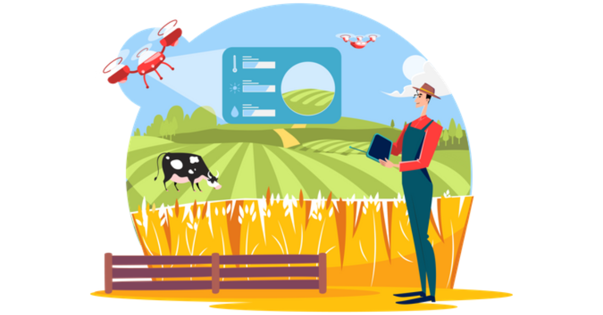
For years, farmers, food and feed processors have always wondered about the conditions of their crops. All thanks to modern day innovations that made it possible to remotely monitor everything through remote sensing technology. Remote sensing in agriculture is becoming increasingly important. 

Space technology is particularly impacting agriculture and has the potential to transform how the sector operates by 2030. sector 

Over the years, Remote sensing technology has proved it’s wide applicational importance ranging from monitoring of crop growth, identifying areas of stress, and to predict yields, optimizing crop management practices and improving productivity. It can also identify areas that require irrigation, fertilizer, or pesticide applications, reducing costs and minimizing environmental impact. 

This blog post aims to understand and upheld the importance of remote sensing in agriculture, right from understanding what remote sensing is, a brief breakdown of types of remote sensing and their applications in farm management and smart agricultural practices. Further part we dive deep to understand the applicational aspects of remote sensing by understanding the real world applications of remote sensing and with the outlook towards the future. 

What exactly is remote sensing? 

Remote sensing is a technology that uses sensors to collect data about the Earth’s surface from a distance. In agriculture, remote sensing has become increasingly important as it provides valuable information that can help farmers make informed decisions. 

There are several types of remote sensing that can be used in agriculture, including: 

  1. Multispectral Imaging: This type of remote sensing collects data in multiple spectral bands, allowing for the detection of different levels of vegetation health and stress. 
  1. Thermal Imaging: This type of remote sensing measures the temperature of crops, which can be used to detect stress caused by drought or disease. 
  1. Lidar: Lidar uses laser pulses to create a 3D map of the crop canopy, which can be used to estimate biomass and plant height. 
  1. Radar: Radar can penetrate clouds and vegetation, allowing for the detection of soil moisture and crop growth beneath the surface. 
  1. Satellite Imagery: It provides a way to monitor large areas of land and crops from a distance, making it easier to identify patterns and changes over time. Satellite imagery is a proven and a valuable tool for farmers and researchers in agriculture. However, satellite imagery can be limited by cloud cover and the resolution of the images. 
  1. Arial Imagery: Aerial imagery involves the use of drones or planes equipped with high-resolution cameras to capture detailed images of crops and fields from above. It allows farmers to quickly and easily monitor the health and growth of their crops, identify problem areas, and make informed decisions about how to address issues such as disease, nutrient deficiencies, or water stress. Aerial imagery can also be used to create detailed maps of soil type and topography, which can help farmers optimize planting and irrigation strategies. 
  1. Unmanned Aerial vehicles: Also known as drones, can be equipped with a variety of sensors and cameras, allowing farmers to collect detailed data about their crops and fields from above. Common uses of UAVs in agriculture are for crop mapping and monitoring. By flying over fields and taking high-resolution images or using sensors to collect data on plant health, farmers can quickly identify problem areas and take action to address issues 

Applications of Remote Sensing in Agriculture 

Increasing interest in Remote Sensing and various attempts have been made regarding the study of agriculture using remote sensing.

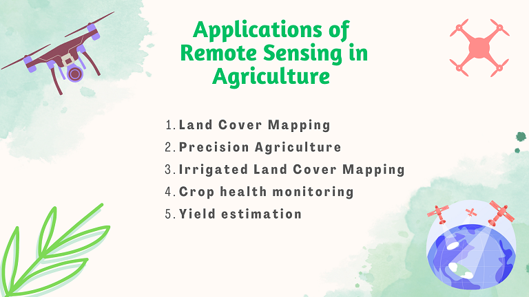
The use of remote sensing in agriculture can range from straightforward tasks like locating fields to complex ones like precision farming. Let’s give a quick look at how remote sensing has helped in agriculture: 

  1. Land Cover Mapping: One of the most widely used remote sensing applications is land cover mapping. Differentiating the various forms of land cover on the surface of the earth is the main goal of land cover mapping. The determination of crop kinds, Land cover, on the other hand, aids in choosing which crops to produce and predicting crop yields. Crop management includes choosing crops based on field and soil type, creating treatment plans to increase crop yields and lower the risk of disease or pest damage. This is accomplished by integrating crop types with current and historical weather and climate, crop yield models, soil characteristics, and market conditions. 
  1. Precision Agriculture: Precision agriculture also called Precision farming refers to collection of methods, tools, and management strategies designed to optimize plant growth and farm profitability by adjusting treatments to suit variable biophysical conditions that occur within an agricultural field instead of applying the same treatment uniformly across the entire area. Due to the advancement in remote sensing and added functionalities in GIS, the characterization, modeling, and mapping of almost any crop have been possible—which is to say, the future of precision agriculture heavily relies upon GIS and Remote Sensing. 
  1. Irrigated Land Cover Mapping: Another important application of remote sensing in agriculture is Irrigated Land Cover Mapping. On the surface of the Earth, satellite observations offer trustworthy, affordable, and synoptic information. The mapping of land cover, especially agricultural lands, is aided by these data. Current strategies for characterizing agricultural land cover are frequently derived from image classification systems. 
  1. Crop health monitoring: By examining spectral data from satellites, aircraft, or ground-based instrumentation, remote sensing can be used to keep an eye on the development and health of crops. Farmers can use this information to pinpoint the parts of their crops that might benefit from additional water, fertilizer, or pest control. 
  1. Yield estimation: Recent advances in remote sensing can also be utilized to calculate crop yields by examining elements like plant height, biomass, and chlorophyll content. remote sensing. Farmers that use this knowledge can more efficiently plan their harvests and take care of their crops. 

The shifts in weather patterns brought on by climate change and global warming endanger crop output. Such changes have an impact on farmers as well as the market for crop insurance because they are difficult to foresee using conventional predictive algorithms. This increases the need for solutions for more accurate risk calculation and damage assessment. Remote sensing has been an breakthrough technology to predict and mitigate these risks. 

Agriculture has a compelling role to play in decarbonization, as it has the potential to both emit and capture carbon. At the same time, a shift to more sustainable on-farm practices – and the adoption of technologies that can support these – is enabling farmers to leverage the carbon cycle, removing carbon from the atmosphere and sequestering it in the soil. Fortunately, technological advancement is remote sensing and satellite imagery are helping farmers and policy makers in understanding the soil carbon stocks. 

Challenges and Future Prospects 

On one hand where remote sensing is gaining scope in agriculture and has revolutionized the way we work. However, it is important to understand that technology is not infallible, and it has limitations. Few of the limitations of remote sensing have been listed below. 

  1. Limited access to data: One of the main challenges in remote sensing is the limited access to high-quality data. Some remote sensing data is only available for a fee, and it can be difficult for farmers to access and use this data. 
  1. Interpretation of data: Another challenge is the interpretation of remote sensing data. The data can be complex, and farmers may not have the expertise to interpret it accurately. 
  1. Cloud cover: Cloud cover can be a major obstacle to obtaining clear remote sensing data. Clouds can block the view of the Earth’s surface, making it difficult to obtain accurate data. 
  1. Technical limitations: Some remote sensing technologies have technical limitations. For example, some sensors are not sensitive enough to detect certain types of vegetation or soil properties. 

The future of remote sensing in agriculture looks promising, with new advancements and developments being made to enhance the technology’s capabilities. Remote sensing has already played a significant role in increasing crop productivity and sustainability, and it is expected to continue doing so in the future. One of the most promising prospects of remote sensing in agriculture is the integration of artificial intelligence (AI) and machine learning (ML) technologies. These technologies can help to automate the analysis of remote sensing data and provide real-time information to farmers. This would enable farmers to make more informed decisions about crop management such as identifying the best time to plant, water, and harvest crops. 

Climate change is also a significant challenge facing the agricultural sector, and remote sensing can play a vital role in monitoring and adapting to changing weather patterns. With the help of remote sensing, farmers can identify areas of the field that are more prone to flooding or drought, allowing them to adjust their crop management practices accordingly. 

The future of remote sensing in agriculture looks bright, and it is an exciting time to be involved in this rapidly evolving field.  

TraceX has been helping companies with their Technology solutions. The platform provides seamless integration with existing technologies through API interfaces. NDVI Satellite imagery helps identify plant vigor within the field as well as the bare soil. Based on project requirements, farms can be configured for remote sensing. Soil health parameters like Soil pH, Soil organic carbon, NDVI and Soil moisture can be captured. 

Conclusion 

Remote sensing has already made a significant impact on agriculture, and the future looks even more promising. With the integration of AI and ML technologies, precision agriculture, disease and pest detection, climate change adaptation, and increased availability of data, remote sensing is likely to play an even more crucial role in increasing crop productivity and sustainability in the years to come. 

Start using TraceX
Transparency, Trust, & Success for your Climate Journey.
Get the demo
[hubspot type=form portal=8343454 id=304874ea-d4e0-4653-9825-707360746edb]
[hubspot type=form portal=8343454 id=b8321ac0-687a-4075-8035-ce57dd47662a]
food traceability, food supply chain

Please leave your details with us and we will connect with you for relevant positions.

[hubspot type=form portal=8343454 id=e6eb5c02-8b9e-4194-85cc-7fe3f41fe0f4]
food traceability, food supply chain

Please fill the form for all Media Enquiries, we will contact you shortly.

[hubspot type=form portal=8343454 id=a77c8d9d-0f99-4aba-9ea6-3b5c5d2f53dd]
food traceability, food supply chain

Kindly fill the form and our Partnership team will get in touch with you!

[hubspot type=form portal=8343454 id=b8cad09c-2e22-404d-acd4-659b965205ec]