Quick summary: Explore how GIS technology is transforming agriculture by harnessing geospatial intelligence for sustainable farming practices. Dive into the applications and benefits of integrating GIS into agricultural operations. Discover the power of data-driven decision-making and unlock a more sustainable future for farming.
In recent years, the agriculture industry has witnessed a technological revolution that is transforming traditional farming practices. One such technology that has gained significant traction is Geographic Information Systems (GIS). GIS in agriculture can be used to improve crop yields, reduce costs, and protect the environment.
FAO estimates that geospatial information including GIS can increase crop productivity by 10 to 20% globally.
Geographic Information Systems (GIS) is a technology that combines spatial data (geographical information) with analytical tools to visualize, analyze, and interpret data related to specific locations on the Earth’s surface. In agriculture, GIS is utilized to improve decision-making, optimize resource management, and promote sustainable practices.
GIS (Geographic Information System) is a powerful tool that can be used to collect, store, analyze, and visualize spatial data. In land use planning and management, GIS can be used to improve the efficiency and effectiveness of decision-making by providing decision-makers with access to detailed information about the land, its resources, and its uses.
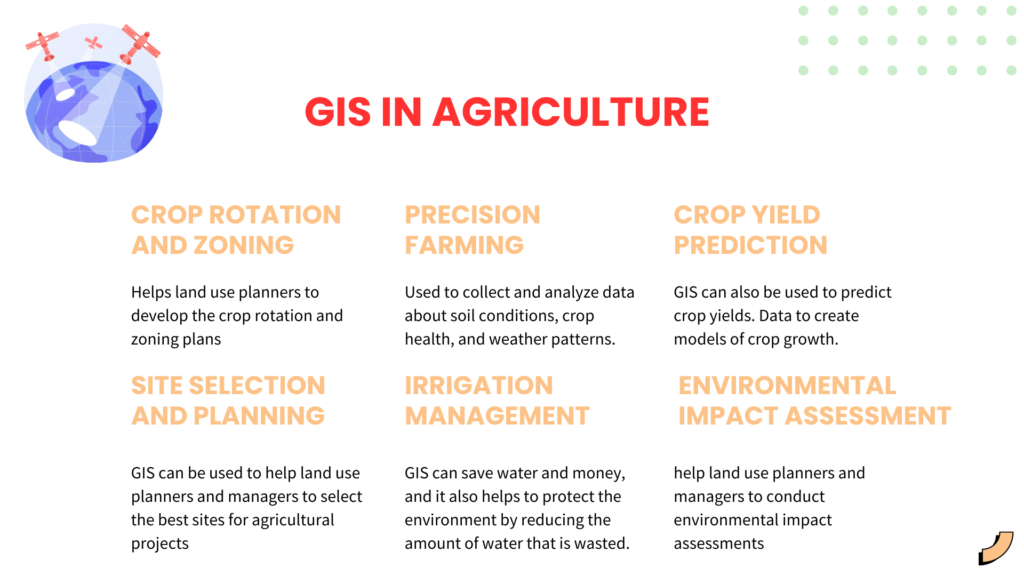
GIS can be used to help land use planners and managers to develop crop rotation and zoning plans Crop rotation plans can help to improve soil health and reduce the risk of pests and diseases. Zoning plans can help to ensure that different types of land use are compatible with each other. For example, a zoning plan might designate certain areas for agricultural use, while other areas might be designated for residential or commercial use.
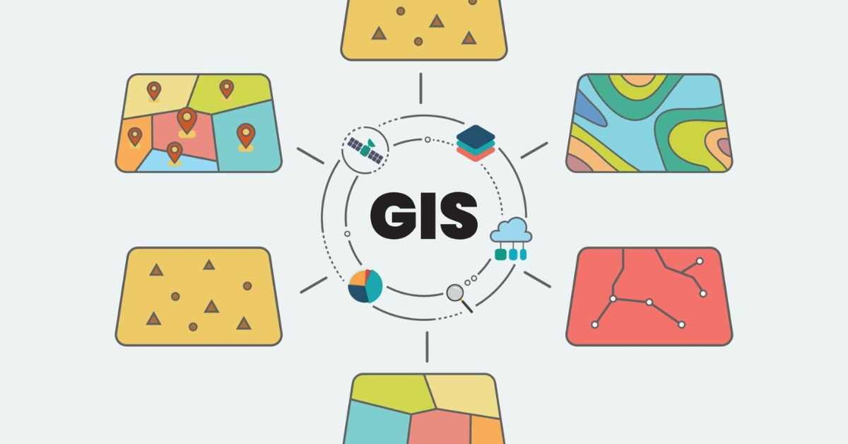
Use cases of GIS
Precision farming is a type of agriculture that uses GIS to collect and analyze data about soil conditions, crop health, and weather patterns. This data can then be used to create detailed maps of the farm, which can be used to make more informed decisions about crop management. For example, farmers can use GIS to identify areas of the field that are more prone to pests or diseases, and then target those areas with more precise applications of pesticides or fertilizers.
Use cases of GIS
GIS can also be used to predict crop yields. This is done by collecting data about soil conditions, crop health, and weather patterns, and then using this data to create models of crop growth. These models can then be used to predict crop yields under different conditions, such as different levels of fertilizer application or different planting dates.
Use cases of GIS
GIS can be used to help land use planners and managers to select the best sites for agricultural projects. GIS can be used to map the location of resources such as water, soil, and transportation, as well as the location of potential hazards such as flooding and pollution. This information can be used to identify sites that are suitable for the proposed agricultural project and that are unlikely to be affected by hazards.
Use cases of GIS
GIS can also be used to manage irrigation systems. By using GIS to map the layout of the farm and the location of water sources, farmers can design irrigation systems that are more efficient and effective. This can save water and money, and it can also help to protect the environment by facilitating water conservation
Use cases of GIS
Here are some specific examples of how GIS can be used for precision farming, crop yield prediction and optimization, and irrigation management:
GIS can be used to help land use planners and managers to conduct environmental impact assessments (EIAs). EIAs are used to identify and assess the potential environmental impacts of proposed projects. GIS can be used to map the location of potential environmental impacts, as well as the location of sensitive areas such as wetlands and wildlife habitats. This information can be used to design projects that minimize environmental impacts.
Use cases of GIS
The future of GIS in agriculture is bright, and there are a number of trends and potential developments that are likely to occur in the coming years.
One of the most important trends in GIS is the advancement of remote sensing and imaging technologies. These technologies allow for the collection of high-resolution data about the Earth’s surface, which can be used to create detailed maps and models. This data can be used to track crop growth, identify pests and diseases, and monitor soil conditions.
Another important trend is the integration of GIS with the Internet of Things (IoT) and Artificial Intelligence (AI). IoT devices can be used to collect data about the environment, such as temperature, humidity, and soil moisture. This data can be used to create real-time maps and models that can be used to make decisions about crop management. AI can be used to analyze this data and identify patterns that can be used to improve crop yields.
The use of GIS in agriculture is likely to expand in the coming years as digital farming and smart agriculture become more common. Digital farming is the use of technology to manage farms more efficiently. Smart agriculture is the use of technology to improve crop yields and reduce costs. GIS can be used to support both digital farming and smart agriculture by providing farmers with access to data that can be used to make better decisions about crop management.
Also note that the challenges are diminishing, here are some additional thoughts on how challenges are turning narrow.
Despite these challenges, GIS is a powerful tool that can be used to improve agriculture in a variety of ways. By using GIS, farmers can increase crop yields, reduce costs, and protect the environment. The challenges and limitations of GIS in agriculture are decreasing, and GIS is becoming a more accessible and effective tool for farmers.
Integrating GIS into their agriculture solutions, TraceX enables farmers and organizations to make data driven decisions that promote sustainability throughout the farming process. GIS allows TraceX to map and analyse spatial data related to agriculture such as soil quality, topography , climate patterns and water availability. This geospatial information provides valuable insights into the land suitability for different crops, helping farmers optimize their planting decisions and reduce environmental impact.
GIS can also help in monitoring the use of agriculture inputs like fertilizers and pesticides. This helps farmers to minimize waste, optimize resource usage and prevent excessive chemical usage, thereby promoting sustainable farming practices. The data on soil moisture levels , precipitation patterns and water usage helps to implement efficient irrigation practices.
Normalized Difference Vegetation Index (NDVI) is one of the most common and efficient indexes for monitoring vegetation. It quantifies vegetation by measuring the difference between near-infrared (which vegetation strongly reflects) and red light (which vegetation absorbs). NDVI ranges from -1 to +1. Historical vegetation and weather data, vegetation indices and soil moisture index and accurate weather data helps farmers in making farmland decisions.
Geographic Information Systems (GIS) has emerged as a powerful tool in the field of agriculture, revolutionizing farming practices and paving the way for a more sustainable and efficient future. Through the integration of spatial data, advanced analytics, and real-time monitoring, GIS empowers farmers and agricultural professionals to make informed decisions, optimize resource management, and enhance productivity.
By leveraging GIS technology, precision farming techniques have become a reality, enabling farmers to tailor their practices to specific field conditions and maximize resource utilization. Crop yield prediction and optimization have reached new heights, thanks to the integration of remote sensing, historical data analysis, and sophisticated modeling within GIS platforms. This allows farmers to make accurate predictions, identify yield-limiting factors, and implement targeted interventions for optimized productivity.
